Informational Open House Scheduled for Daryl Carter Pkwy., Sand Lake Rd. Design Plans

|
| An open house for proposed design plans for improvements to I-4 interchanges at Daryl Carter Parkway and Sand Lake Road is scheduled at the Rosen Jewish Community Center on Apopka Vineland Road. |
| |
The Florida Department of Transportation (FDOT) will hold an informational open house from 5 p.m. to 7 p.m. on Wednesday, June 26, to discuss proposed design plans for improvements to the Interstate 4 (I-4) interchanges at Daryl Carter Parkway and Sand Lake Road (State Road 482).
The open house will be held at the Rosen Jewish Community Center (JCC) at 11184 S. Apopka Vineland Road, Orlando.
The goal of the design projects is to improve mobility and safety by reducing congestion on I-4 in south Orange County and adjacent roadways.
The I-4 and Daryl Carter Parkway design project includes:
- Converting the Daryl Carter Parkway overpass into a diverging diamond interchange.
- Adding eastbound I-4 entrance and exit ramps and a westbound I-4 exit ramp at the new interchange. The westbound I-4 entrance ramp will be constructed at a later time with the final configuration.
The I-4 and Sand Lake Road design project includes:
- Reconstructing I-4 general use lanes from west of Sand Lake Road to the end of the I-4 Ultimate project, west of Kirkman Road (State Road 435).
- Reconstructing the Sand Lake Road interchange into a diverging diamond interchange with a loop ramp to Turkey Lake Road.
The open house will provide information about the proposed design projects. The FDOT team will be available to answer questions and explain the proposed improvements with the help of large display maps, a video presentation and informational handouts.
For more information about I-4 Beyond the Ultimate and the proposed design plans for Interstate 4 (I-4) interchange improvements at Daryl Carter Parkway and Sand Lake Road, visit i4beyond.com.
|
|
Technology to Help Your Commute
Traffic information is widely available to help drivers make better choices about their daily commutes and other trips. Navigation apps, websites, and TV and radio traffic reports give information about congestion, construction, and crashes creating delays on the roadway.
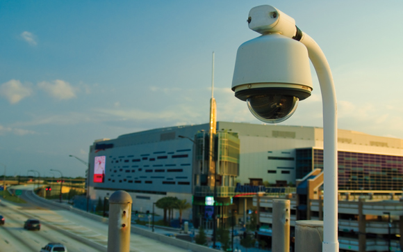
The Florida Department of Transportation’s (FDOT) Regional Transportation Management Center (RTMC) is the original source for much of that information. And one of the center’s most important tools is the state’s smart data network.
FDOT’s Intelligent Transportation Systems (ITS) program helps the department manage traffic through collecting and analyzing data, then studying it at the RTMC, and sharing information with drivers to help them safely and efficiently reach their destination.
In Florida, ITS comprises:
- Roadside technology, including CCTV cameras and vehicle detectors that monitor the speed and volume of traffic, and detect incidents, crashes, and congestion.
- Software that gathers the data and enables operators to understand what’s happening on the roadways, then act to solve problems.
- Communication tools, including Florida 511, overhead message boards, connected vehicle applications, and truck parking availability systems, all of which allow operators to let drivers know about roadway conditions and encourage them to seek alternatives.
- Smart traffic control systems, such as intelligent traffic signals, ramp meters, variable toll systems, and transit priority systems, help operators manage traffic flow.
- The RTMCs that serve as the operations centers, housing the people and technology.
- A network of fiber-optic and wireless connections that keep ITS data flowing from the roadside to the RTMC and back out to the drivers.
- People, including engineers, operators, Road Rangers, and other first responders, whose expertise helps keep traffic on Florida roadways moving efficiently and safely.
Expect even more data from intelligent transportation systems in the future. Connected vehicle technology is the next generation of ITS. Vehicles and infrastructure are already able to communicate with each other. Vehicles send information about their speed, location, and roadway conditions, and then receive safety messages back, which are displayed to their drivers. This data lets FDOT further assist with traffic management and provide drivers with the most recent updates on roadway conditions.
|
|
PD&E Studies Help Protect Cultural and Historical Resources

|
| Researchers use historic maps such as such as the above that shows the Lake Monroe area in the mid-1840s, to find possible sites of historical interest and to see how roadways have changed. It's part of the Cultural Resource Assessment Survey for the PD&E study. |
| |
Although the Florida Department of Transportation (FDOT) has monitored traffic and population growth in many areas of the state for decades, all major road projects must undergo a thorough review called a Project Development and Environment (PD&E) study before being approved.
So, before the I-4 Beyond the Ultimate projects could move forward, they were studied and analyzed from many angles to assess environmental, social, and economic impact. The public may be familiar with studies that look at water, air, animal life, vegetation, and noise, but a great deal of effort also goes into assessing whether there are any places of cultural or historical significance in the affected areas.
As part of the Cultural Resource Assessment Survey, specialists searched along the 40 miles of Interstate 4 (I-4) in Central Florida that make up I-4 Beyond the Ultimate for sites and structures that could be considered to have historical value. They examined buildings, bridges, cemeteries, and places where important events might have occurred – anything with historical, cultural, architectural or archeological significance.
Experts then assessed sites and structures for their historical value and also analyzed shovel samples to determine whether there was archeological material in the areas impacted. Researchers also looked over new and old maps, recent and past aerial photos, earlier studies, and historical documents, looking for clues that might lead them to sites of cultural or historical prominence.
Structures and sites also were reviewed to see if they were candidates for the National Register of Historic Places or similar designations that protect and preserve noteworthy buildings and locales. Due to concerns about some sites being disturbed by collectors of ancient artifacts, the locations of archeological interest are not made public, in accordance with Florida statutes. But any findings are documented, and notable materials are preserved for future study. Much of that work is done under the guidance of the Florida Division of Historical Resources.
|
|
Learn More About PD&E’s Geotechnical and Pond Siting Studies
Project Design & Environmental Studies shape and guide design plans. Two studies — Preliminary Geotechnical Engineering Investigation for Ponds and Pond Siting Report — help the Florida Department of Transportation (FDOT) decide where to build new stormwater ponds.
Watch this short video to learn more about the Geotechnical and Pond Siting studies on I-4 Beyond the Ultimate or visit i4beyond.com/pde to view these studies for each of the I-4 Beyond the Ultimate design segments.
|
|
|